La Niña Officially Returns: Here’s What It Means for Winter in the United States
The weather pattern known as La Niña has made its return for a second consecutive fall and winter. This event is part of the El Niño Southern Oscillation (ENSO), a natural cycle that changes global weather patterns by altering water temperatures in the central Pacific Ocean. Knowing how La Niña affects our weather is key since it shapes local climates as well as broader conditions, influencing agriculture, water supplies, and energy use.
Getting to Know La Niña and ENSO
La Niña happens when the water in the central Pacific Ocean cools to more than 0.5 degrees Celsius below normal. This cooling is the opposite of El Niño, when water temperatures rise more than 0.5 degrees Celsius above normal. When temperatures fall between these extremes, we call it “La Nada.”
Recent ocean readings confirm this cooling trend, with temperatures dropping to 0.5 degrees Celsius below average (-0.9 degrees Fahrenheit). In response, the NOAA’s National Climate Prediction Center has issued a La Niña Advisory to flag potential shifts in upcoming seasonal weather.
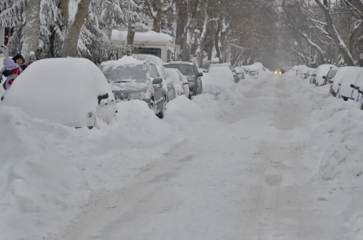
Shifts in Weather Patterns
La Niña plays a big role in changing our weather by tweaking jet stream patterns. It usually makes the Polar Jet Stream dip further south across the northern U.S. while steering the Pacific Jet Stream toward the West and Northwest coastlines. This has meant cooler, wetter weather for places in the Pacific Northwest and upper Northern Plains, while areas like Texas see milder and drier winters.
On top of these trends, La Niña can worsen droughts in the Southwest and bring above-average mountain snowpack to the Pacific Northwest. The Great Lakes region often gets more rain or snow during these periods. That said, other large-scale factors and short-term weather swings can sometimes override these common La Niña signals.
Changes in the Hurricane Season
La Niña also has a hand in affecting hurricane activity. By reducing wind shear over the Atlantic tropics, La Niña usually sets the stage for more active hurricane seasons. However, this year’s La Niña started too late to have much of a say in the current hurricane season.
What the Forecast Says
Current predictions for this La Niña indicate that it will stay on the weak side, with sea surface temperatures not expected to drop more than -0.9 degrees Celsius below average. There’s a 55% chance the conditions will shift back to neutral by mid-winter. These projections have shaped NOAA’s seasonal forecasts, which point to below-average temperatures, especially in northern regions like the Pacific Northwest during the November-January and December-February periods.
Rainfall forecasts match these trends, expecting above-average precipitation or snowfall in the north and drier weather in the south. NOAA will release updated seasonal forecasts on October 16 to give us more details about what this winter might bring.
Looking ahead beyond winter, once La Niña fades, neutral ENSO conditions are expected to hang around into spring. During the spring and summer months, ENSO’s role usually lessens across the Continental U.S., giving way to other weather factors.
With La Niña back in play, it’s clear that this pattern continues to steer significant shifts in weather across North America and beyond. As NOAA forecasters put it: “A weak La Niña would be less likely to result in conventional winter effects, though predictable signals could still influence forecast guidance.” Staying updated on these developments can help everyone plan better for what’s coming.